
Several years ago while in Scotland we met some folks who were hiking, pub to pub, through a section of Scotland. The idea intrigued us— slowing down the travel time, spending some time walking through the villages, meeting up with local walkers. But carrying a backpack with all our possessions? No way. Then a friend took a long walk through England and told about a local company that carried her bags from place to place and made lodging arrangements, leaving her just to lug a day pack. That we could manage!
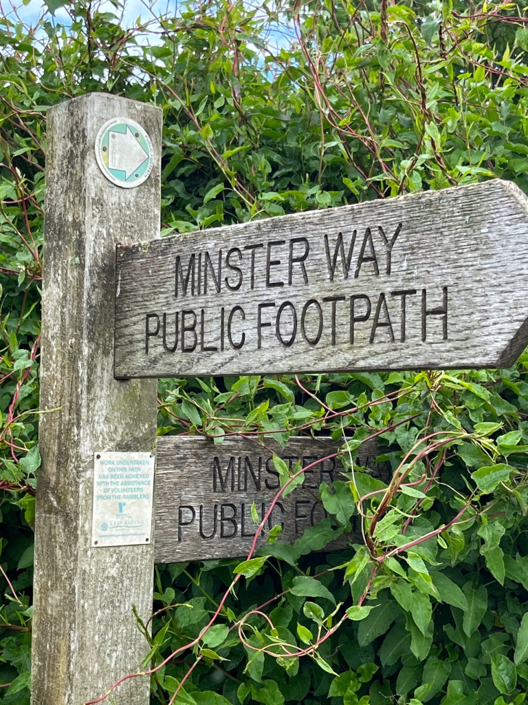
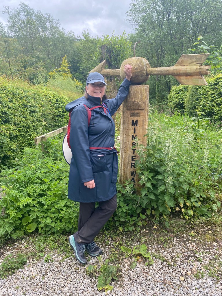
We had never been to York and thought we wanted to walk for three or four days. We checked with one of many different companies that support this kind of independent walking trips and picked a 50 mile walk out of York — The Minster Way — a ramble from the Beverley Minster to the grand York Minster through the East Yorkshire Wolds. We signed up, booked our tickets and then Covid hit. Two and a half years later we boarded our flight.
The actual walk began in Beverley. We were loaded with information — two published narratives, describing the walk. Four actual topographical maps charting our walk plus all the others in the area. One electronic version of a topographical map and, of course, Google maps. All were insufficient to get us out of Beverley. We were finally guided out by a kind gentleman walking his dog in suburban Beverley. A small celebration when we finally found the first of the signs directing the way.
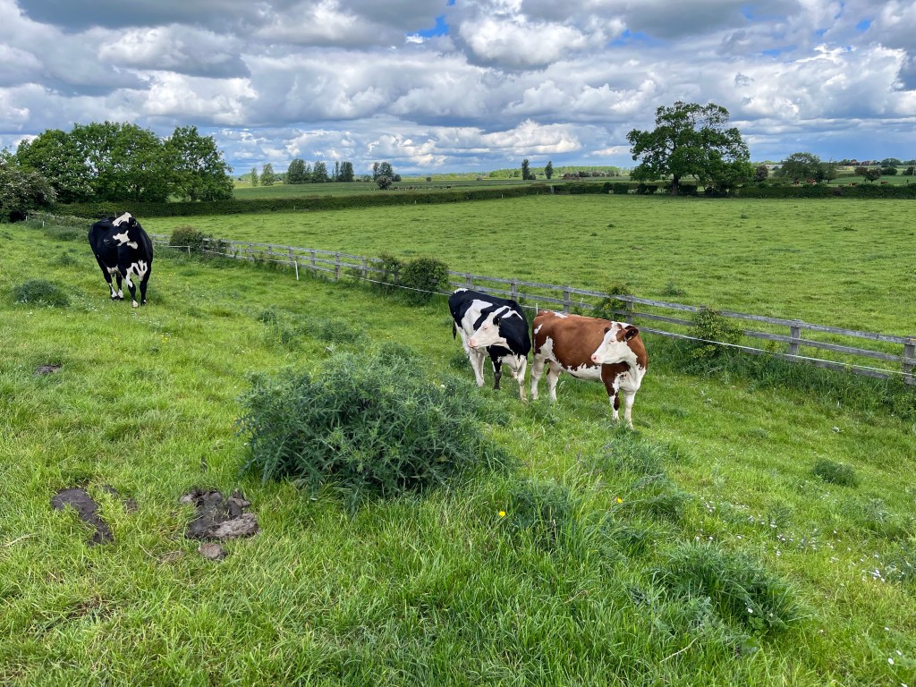
At first it was a bit disconcerting to weave through a gate, reading the signs warning of bulls in the pastures, but they seemed pretty accustomed to the occasional walker to be even be bored by our appearance. That is, except for one group of young bulls, that began to run as we got close. Then they stopped about 20 yards ahead on the path, turned to look if we were still coming and would set off again. Eventually they turned and at a safe distance thundered past us. Soon walking among the animals didn’t cause us a second’s pause. Often despite the warnings, the pastures were empty.
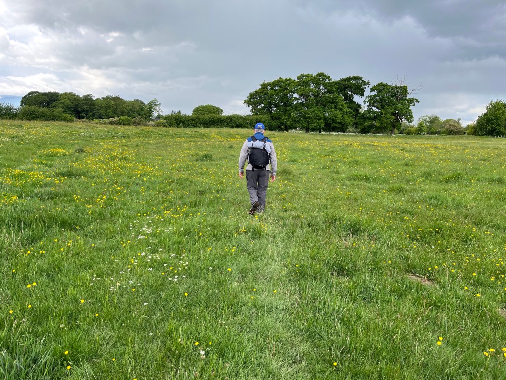
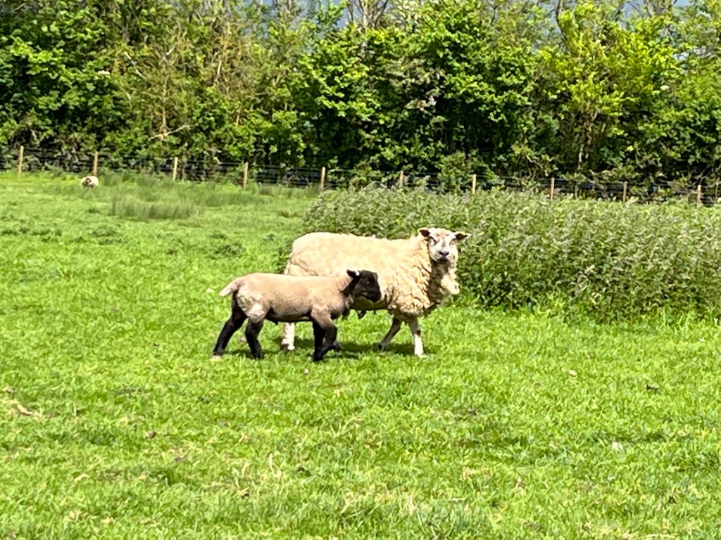
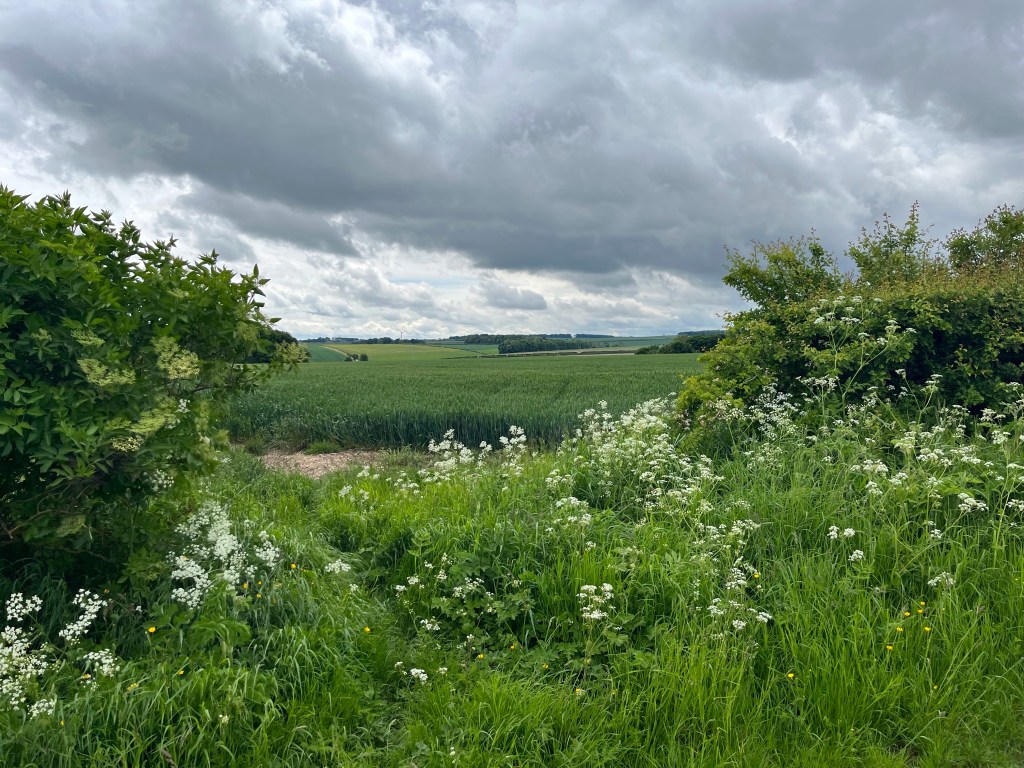
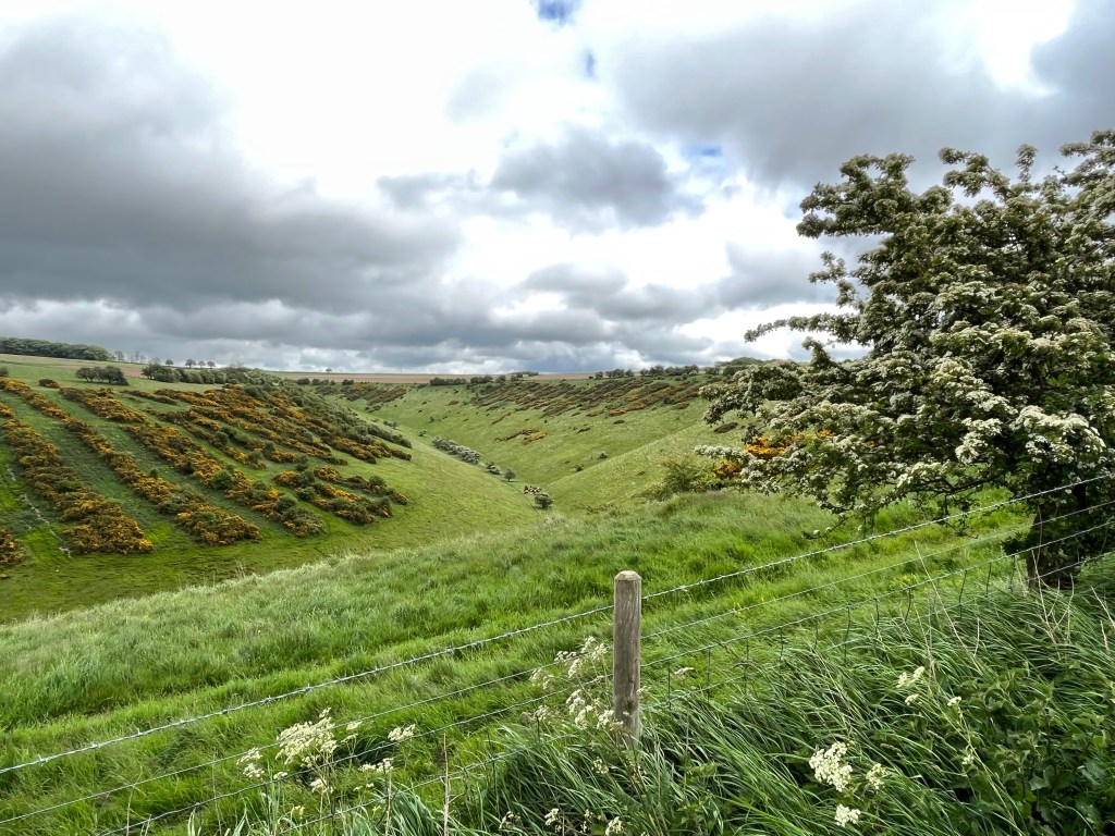
The first two days took us through fairly flat, agricultural land — huge fields of wheat, rye and other grains plus pasture of caws and pens of sheep. Interspersed among the fields were small patches of trees and an occasional road or track for farm equipment.
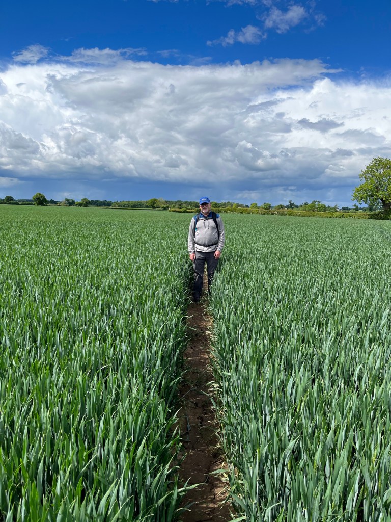
Most of the path went right through the planted fields and up close and personal with the animals and around outbuildings for farms.
At one point the path led us into a field of wheat and appeared to stop. A couple in the distance waved us forward and with some trepidation for stomping on valuable wheat we proceeded. Turns out the couple was out weeding their field by hand, removing a noxious weed that is impervious to herbicides, or at least those that could be used in a wheat field.
We also ran into the estate manager for a large operation. He explained that much of the rye in the area could be sold at about $100 more a ton if used in energy conversion plants which operated in the area. And while potatoes were also grown in the region, the chalky soil spoiled their looks so they were only used for seed.
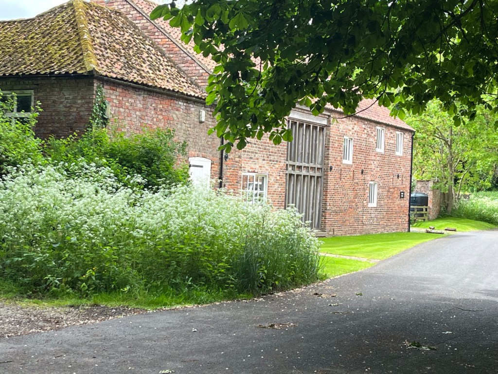
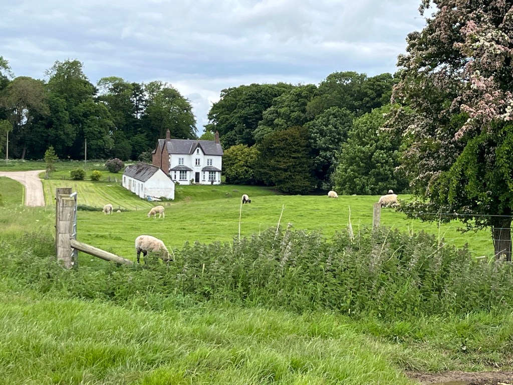
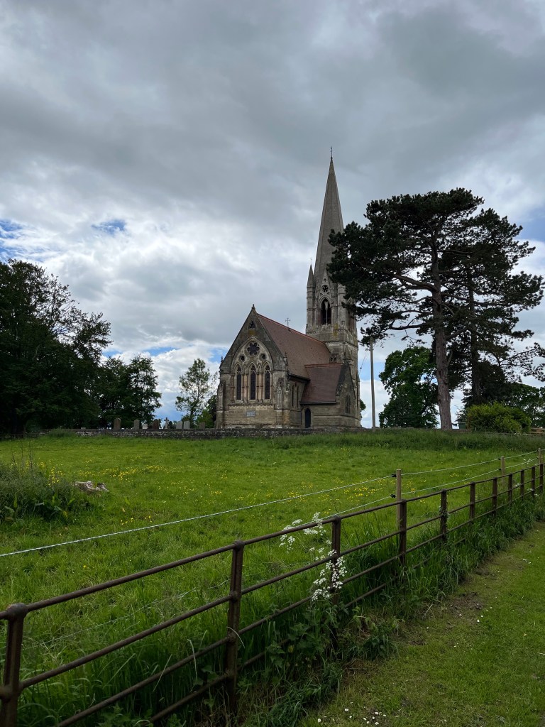
But these two encounters were the exception in the first 25 miles. Mostly we walked alone, not seeing a business, a cafe, a pub or any commercial business in any of the tiny hamlets we walked through until the end of the second day. We did pass through small villages, usually a collection of homes, farm buildings and a church.
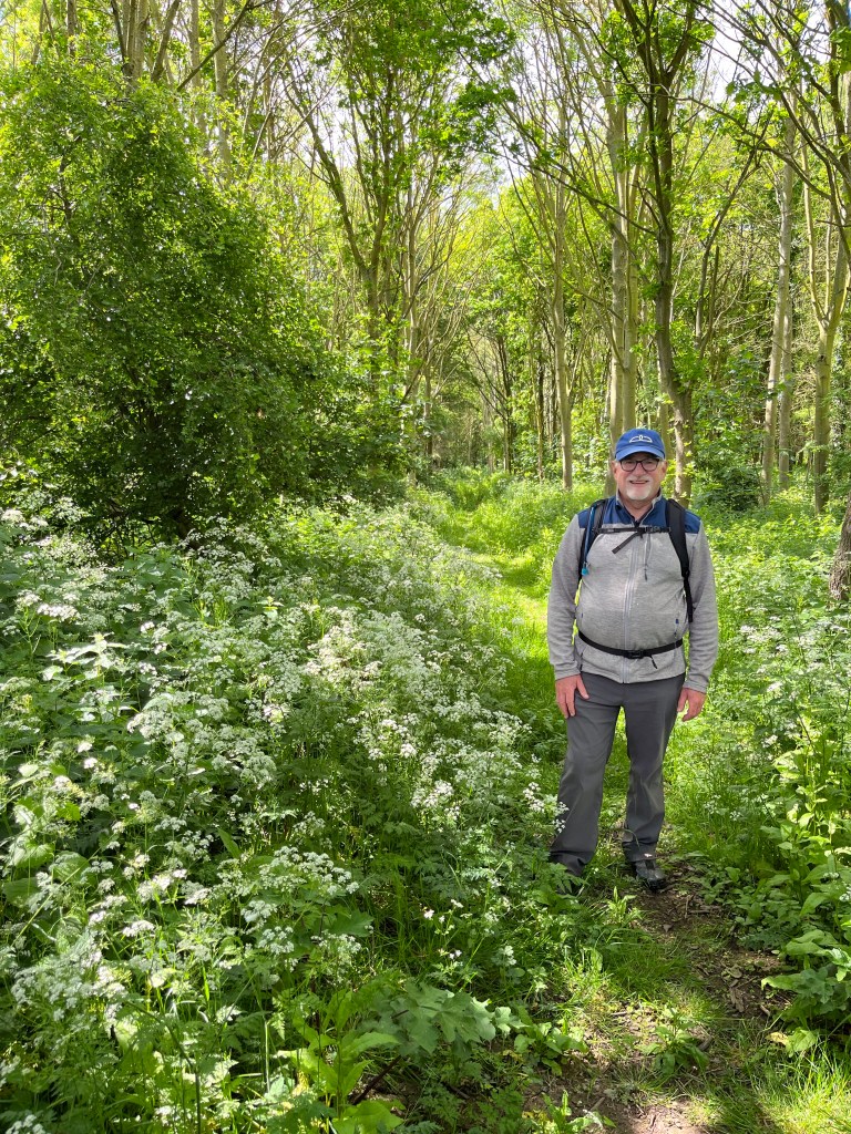
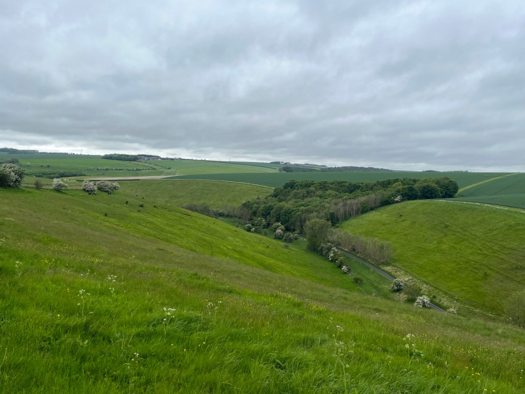
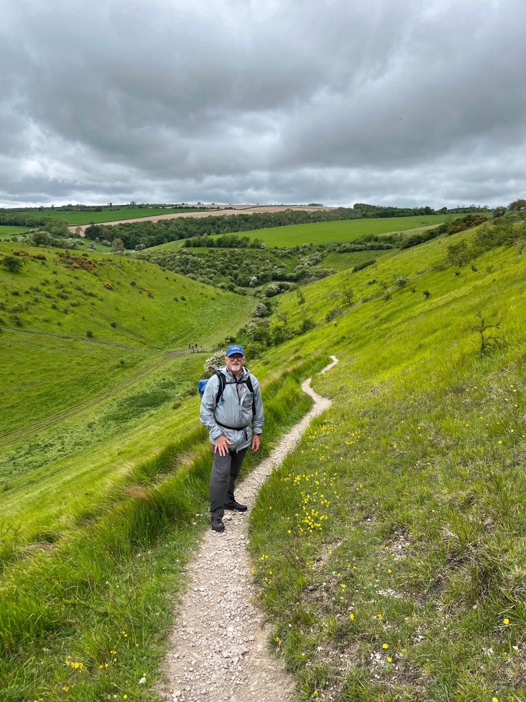
That changed on the third day as we entered the most hilly and scenic part of the trail. Suddenly we started meeting groups of walkers. We all praised the weather (cool and mostly dry), agreed the sights were spectacular and lightly complained about the rigor of going up and down the hills. The complaints were warranted. Apparently, no one here believes in switchbacks so trails go pretty much straight up and straight down. A challenge for the knees, for sure.
It wasn’t all bucolic, however. While the trail was generally well marked, we did manage to get lost — twice. The first time was sheer stupidity. We had a visual image of our B&B for the night and manage to walk right past the place because the building closest to the road did not match our picture, despite the signage. Once again it was the kindness of strangers that got us back on track — this time a man out to get his day’s exercise on his bike. He pointed us in the correct direction with clear landmarks to watch for.
The second time we got lost was really not out fault. Our host at the previous night’s B&B dropped us off at the trailhead. Unfortunately she left us at the wrong trailhead and it took two hours and four miles of map checking, walking, head scratching and googling to find out where we were. At which point we abandoned the trail we had planned to walk and simply took the trail in front of us. The two trails intersected a few miles down the way, according to the maps. Crisis managed!
What were the highs and lows? The biggest problem was our own fault. We did not do enough research on the walk itself. Not until after we had booked the walk and been given the list of our lodgings did we realize how remote the Minster Way route was. We were booked into four places — a glamping site (turned out to be delightful) a Farm B&B (better suited for country house party than sweaty walkers carrying a bit of animal dung on their boots) a quintessential pub and a suburban home with a spare room. When we asked for some modifications in the accommodations, we were told that was all there was along the trail. After walking it, we believe it! One or two other pubs that might have been options went under during the pandemic.
Secondly, we had forgotten how tiresome it is to unpack each evening and repack each day. It is really a drag to live out of a suitcase, even if someone else delivers your bag to you. There’s a reason why we aren’t backpackers at home,
What did we love? The flip side of the remoteness was also a plus. When we paused in our walking, often the only sound to be heard were the birds in the hedgerows. A Northern Lapwing flew overhead and we could hear the wing beats. As casual birders we added nearly a dozen birds to our life list. The quiet, the peacefulness, time alone.
The landscapes seemed so vivid, often picturesque and sometime just plain stunning. As a fans of the new version of All Creatures Great and Small, we could easily envision James Herriot driving around there hills.
Would we do it again? Yep, but differently. Maybe pick a single place to do multiple day hikes out of over several days. Maybe rely upon buses or trains to move us through the less visually rich sections. (In East Yorkshire, taxis have become an endangered species since the pandemic and too scarce to rely upon). But our first taste of long walks in the British Isles definitely left us wanting more.

This was so much fun to read. It took me back to the classes I took at North Seattle CC from Richard Hayward and his guide books on walking the Footpaths in England and Scotland! My neighbor Pat and I did a part of the Cornwall Coast Path but had reached your conclusion before we left and had booked places to stay in Penzance. Taking a bus from there was a good way to walk for the day, return to a known place and then adventure out the next morning. That worked well for us. I also found that using the Tourist Information offices for the various locations worked well for booking boat trips, rooms, etc. before we left! Our trip to Cornwall was tremendous! I want to go back! So glad you have discovered this method of seeing Great Britain! Thanks for the memories! Oralee
>
LikeLike